Trusted by sailors since 1978 – available in print & eBook
Preface About the Guide
We have found that that our favourite cruising guides give us cultural and historical information, provide ideas for shoreside activities and that are organised so we can easily decide where to go and what to do, not just how to get there.
With that in mind, we continue the Norwegian Cruising Guide to be a guidebook rather than just a book of sailing directions.
As we share Phyllis’ and John’s passion not only for sailing, hiking and skiing but also to immerse ourselves in the landscape and culture of the places we visit, we are proud and humble to continue their legacy of this well-organised resource that will help you plan and execute your cruising in Norway as well as provide information on activities that will add to your enjoyment of this wonderful country.
General Information – available online
We have compiled a comprehensive free online edition of general cruising information which is regularly updated when we become aware of any relevant changes. This information is available exclusively on this website where can also be downloaded and printed but we recommend to consult the online version as it is updated when and if we become aware of any relevant changes:
Sections
- Norway: divided into chapters providing cruise planning information and guidance on issues such as boat preparation, Customs and Immigration regulations, buoyage and sample itineraries;
- Svalbard, including Bjørnøya: divided into chapters providing cruise planning information and guidance in addition to the Norway chapter and specific to a cruise to Svalbard and Bjørnøya, such as polar bear protection, ice information and Search and Rescue insurance requirements;
- Jan Mayen: divided into chapters providing cruise planning information and guidance in addition to the Svalbard chapter and specific to a cruise of Jan Mayen, such as nature reserve regulatioions;
- Appendix: divided into chapters with detailed resource information, such as types of Norwegian propane regulators and contact information for boatyards and winter storage options.
Site Navigation
Table of Contents in the side bar of the screen.
There are numerous links within the volume and also to external sources.
Grey boxes are Notes
Blue boxes are Tips
Pink boxes are Alerts
Volumes 1, 2, 3 and 4 – available in Paper and eBooks
- Volume 1: From the Swedish Border up to and including Bergen
- Volume 2: From Bergen up to and including Bodø
- Volume 3: From Bodø to the Russian Border, including Lofoten and Vesterålen
- Volume 4: Bjørnøya, Svalbard and Jan Mayen
Interactive eBooks
In 2006 Phyllis and John broke new grounds by publishing the Guide as an eBook. Since then they have taken the eBooks to the next level by making navigation fast and easy, with thousands of links both to internal and external resources. Available through Apple iBooks and Google Play.
Print-On-Demand (POD) Paper Books
The paper books are print-on-demand, available at bookstores and Amazon. This allows us to publish low-volume books with lots of photographs and frequent updates, though it does mean that the colour photograph reproduction is somewhat compromised. If you want to see the colour photographs in all their glory, buy the eBooks, or even better – just sail there!
Since writing out the full URL for all links would make the paper book longer, messier and harder to read, and copy tying long URLs is difficult to impossible, we have indicated all links with a descriptive tag instead of the underlying URL. If you want access to those resources, then the eBooks are the way to go.
Format
Text
Design
The text is carefully designed to be readable both, on paper where line length should not exceed about 10 words, and on screen, where multiple column layouts are a nightmare to read. The fonts were chosen for legibility and the size with middle-aged eyes in mind. The white space to the left gives room for information boxes and your notes.
Italicised Type
Indicates the names of vessels, publications and words (other than names) in any language other than English.
Bold Type
Refers to places that have their own entry in the Guide and an entry in the Index.
Norwegian Alphabet
Due to a bug in the Adobe Creative Suite, the Index does not recognise the Norwegian characters of Å/å, Ø/ø and Æ/æ. They are treated respectively as A/a, O/o and Symbol/a. We apologise for any confusion this may cause.
Measurement Standards
Nautical miles are indicated by nm and speed in knots by kt. Otherwise, all distances, depths and weights are given in metric (a metre is indicated by m, a kilometre by km, etc.) and temperatures are given in degrees Celsius. Norwegian money (kroner) is indicated by kr.
Courses and Bearings
Courses and bearings are given true unless otherwise noted.
Navigation Coordinates
The coordinates for harbours and anchorages are in WGS 84 degrees and decimal minutes (DD° MM.dd’) format and are given to help you find them on the chart. They are approximate, unless otherwise stated, and should not be used for navigation.
Names
The format for naming harbours and anchorages is as follows:
- The name of a harbour or anchorage is taken from Norway government cartography, Den Norske Los (The Norwegian Pilot) and local information when we have access to it;
- If there are conflicting names for the same anchorage, they are denoted in the title with an”or”, for e.g. Kjøvangen or Kjøvangbukta;
- If an otherwise unnamed anchorage is located between two islands, for e.g. between Løvøya and Mellomøya, it is denoted as Løvøya/Mellomøya, with a slash between the islands.
- If the anchorage or harbour is unnamed or has the same name as the island it is on, it may have the side of the island it is on in brackets after the name; for e.g. Haramsøya (SE) means the anchorage or harbour on the SE side of the island of Haramsøya.
Harbour Information Boxes
These are the grey boxes in the sidebar of each entry in the Harbours and Anchorages chapters.
For each entry is provided:
- The lat/lon coordinates for the harbour or anchorage;
- The year the entry was last updated or the harbour was last visited;
In order to help make it as easy as possible for you to plan your cruise, we also offer these live links in the eBooks:
- Google: links to Google Earth;
- Website; links to the website for that town, area or harbour;
- Tope Map (Svalbard, Jan Mayen): links to topographical maps.
An example from Skudeneshavn in the Stavanger to Haugesund chapter of Volume 2:
- 59°08.92’N, 05°15.42’E
- Last Updated: 2020
Graphics
Chapter Maps
Each chapter starts with a map of the area covered:
- The names of islands and other land features are in dark brown type and the names of channels and fjords are on dark blue type;
- Every port and anchorage that has its own entry in that chapter is shown in black type, its position indicated with a black dot;
- The position of landfall harbours are indicated by red squares and the positions of our favourite harbours and anchorages are indicated by red stars;
- In cases where the chapter has been divided into subsections for easier navigation, we have shown this on the chapter map using dotted black lines to denote the various sections, with a link (live in the eBook) to the page number of the section;
- In cases where the density of ports would make the subsection confusing, we have provided larger-scale subsidiary maps, which are indicated by shading within the dotted black lines on the chapter map;
- With the kind permission of Norway’s government chart organisation (Kartverket), the Coastal Danger Areas are shown in red, together with the conditions that make them most dangerous;
- A scale on the maps is not included but distances can be inferred from the latitude scale.
No attempt has been made to show low bridges, low hanging cables or shallow water that could restrict a boat from using passages shown on the chapter maps; therefore, detailed route planning should only be done with the relevant charts at hands.
Sketch Maps
With the kind of Norway’s government chart organisation (Kartverket), Den Norske Los’ (DNL) sketch maps are embedded into the entries when available.
In a few cases where the harbour is complicated and an illustration clarifies the text, or where charting is poor or non-existent and DNL did not provide a sketch map, our own is provided.
The official charts should always be used for navigation rather than the sketch maps, which are not up-to-date
Photographs
In selecting photographs for inclusion in the Guide, we have gone for a mix of scenic and illustrative in keeping with the philosophy that this is a guide, not just a pilot. We want photographs to give you a feel for what the surroundings are like, not just where to anchor.
Sources of Information
Contributors
General Information
Written by Daniel and Hans Jakob. Updated regularly as and when required.
Volumes 1, 2, 3 and 4
If an entry uses the first person, the information was collected either by Hans Jakob and Eli or Kathrin and Daniel.
Though the majority of information was collected by Hans Jakob and Eli, cruisers other than the four of us and particularly also Phyllis and John have contributed over the years. In those cases we refer to “our contributor”, “Phyllis Nickel and John Harries” or some such.
Kartverket
We use the online PDFs of Den Norske Los as a reference when compiling harbour and anchorage information. Also, Kartverket generously gave us permission to embedd DNKL sketch maps into our entries where available and to use their Coastal Danger Areas information in our chapter maps.
History of The Guide
In 1978 Mark Brackenbury’s Norwegian Cruising Guide, A Pilot for the Norwegian and SW Swedish Coasts between Sognefjord and the Sound was published; until it went out of print in 1991, it was the only English-language marine guide to Norway.
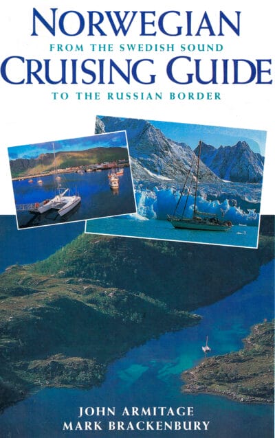
In 1996 John Armitage combined Mark’s material with new material for North Norway, Svalbard and Jan Mayen, and published the jointly authored Norwegian Cruising Guide, From the Swedish Sound to the Russian Border, 2nd Edition.
Between 1996 and 2006 updates were made to the Norwegian Cruising Guide, 2nd Edition, based on the cruising experiences of a number of people, including John Armitage, Hans Jakob and Eli and Phyllis and John.
In May 2006 Phyllis and John published the prerelease version of the much expanded 3rd Edition and the final version was released in February 2007. They published new editions in 2008, 2009, 2010, 2013, and 2017.
Updates
In 2019 Phyllis and John moved away from editions to stamping each volume with the year it was last updated:
- Volume 1: online and as up-to-date as we can make it!
- Volume 2: 2021
- Volume 3: 2023
- Volume 4: 2019
- Volume 5: 2017 (but not stamped yet)
We will let you know here when we are planning to update a volume.
If you purchased a paper book just before we updated it, we are sorry, as we know that is irritating. But that has always been a risk with paper books. If you don’t want to buy the updated paper book, the best option is to buy the less expensive eBook for the same volume.
Sign up here to be notified by email regarding any updates to the Guide
Thank You
- Phyllis Nickel and John Harries for their excellent work in updating the Guide from 2002 to 2025 and for bringing the Guide to the next level and their generosity in handing the results over to us.
- Mark Brackenbury and John Armitage for their hard work and dedication in compiling and updating the Guide from 1978 to 2002.
- Kartverket for granting us permission to copy Den Norske Los sketch maps and to use their Coastal Danger Area information in our chapter maps.
- The many cruisers over the years who have contributed updates and photos to the Guide.